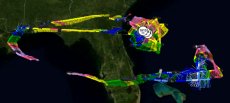
Select a storm to view reconnaissance data for that system. To select data for a different year, select a year below the list of storms for the latest available year. This archive updates in real time.
Eastern North Pacific & Central North Pacific Basin in 2024
Named Storms
No available data.
Depressions
No available data.
Suspect Areas
No available data.
Any mission that has not been tasked by the National Hurricane Center will appear in the archive at the link above. Research missions, including ones that are tropical, and winter missions will appear in this section of the archive.
North Atlantic Basin in 2024
Depressions
ThreeJune 30 - July 1
1 Mission

Suspect Areas
Second (BB)June 20 - June 21
Highest Flight Level Wind: 34 knots
Highest Est. Surface Wind: 37 knots
Lowest MSLP: 1014 mb (extrap)
2 Missions

Any mission that has not been tasked by the National Hurricane Center will appear in the archive at the link above. Research missions, including ones that are tropical, and winter missions will appear in this section of the archive.
Western North Pacific Basin in 2024
There is currently no available data for this basin in 2024.